







What Is 4DSKY and Why Home Miners Shouldn’t Sleep on It!
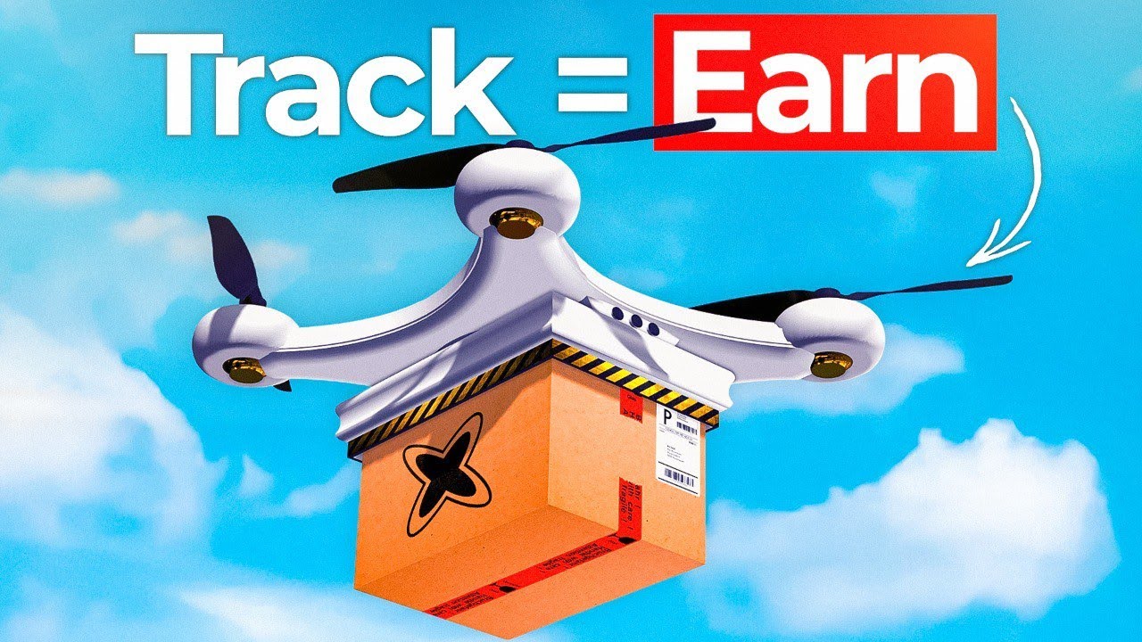
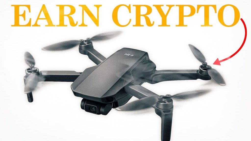
Near my house in central Pennsylvania sits a massive Amazon distribution center. Every single day, thousands of delivery trucks roll in and out of that facility, carrying packages to doorsteps across the region. Now picture a different scene: that same package, instead of arriving on a truck days later, dropped onto your porch by a drone just hours after you order it.
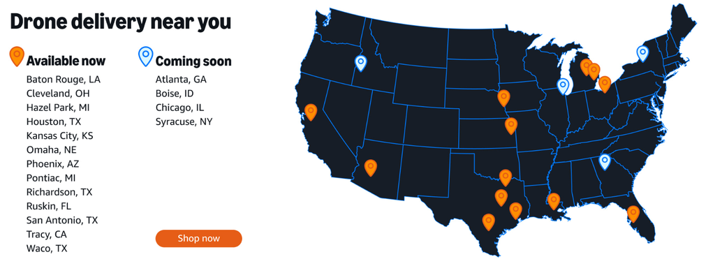
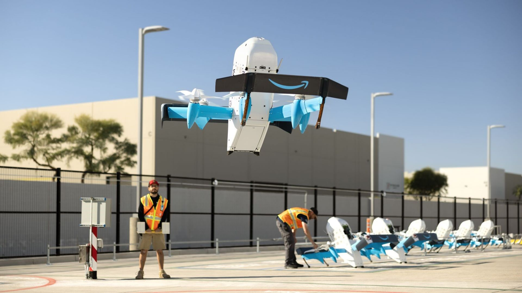
If your first reaction is “yeah, right,” you’re not alone. But this isn’t science fiction. Amazon is already delivering packages by drone in test cities across the United States, including locations in Texas, Arizona, Michigan, Florida, and Kansas City. Walmart is moving in the same direction with same-day drone delivery. Amazon has even secured a patent for an airborne warehouse: a blimp floating overhead that launches drones to deliver packages below.
So what does any of this have to do with crypto mining? That’s where 4DSKY comes in. It’s one of the most innovative DePIN projects I’ve come across in a very long time, and after running a unit on my property for about a year, talking with the team, and digging through the details, I want to break down exactly what it is, what problem it solves, and why I think home miners should have it on their radar today!
what is 4dsky?
At a 50,000-foot level, 4DSKY is a public edge sensor network with a mission to track everything in the sky in four dimensions: latitude, longitude, altitude, and time. That includes commercial airliners, helicopters, gliders, blimps, and yes, drones.
The project is built by the team at Neuron, and its roots run deep in the drone industry. I recently sat down with James from Neuron on the Everyday Miner podcast, and his background explains a lot about why this project looks the way it does. James has spent roughly 16 years in drone technology, with published research in collision avoidance systems. He’s flown commercial drone missions for surveying, rail and road infrastructure, construction, and agriculture. He’s 3D modeled Big Ben and surveyed Buckingham Palace. In other words, this isn’t a team that discovered drones last year and slapped a token on a hardware box. They’ve been building this infrastructure for about six years.
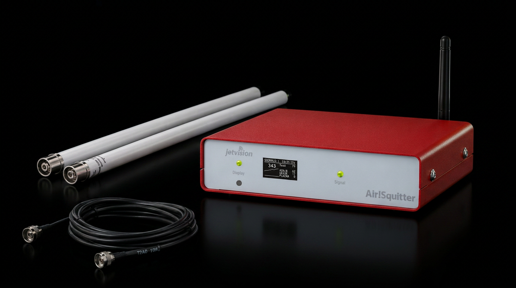
The hardware that powers the network is the Jetvision Air Squitter. Yes, that’s really the name. It’s a small red box that connects to one or more antennas, plus power and internet, and it listens for the signals that aircraft broadcast as they fly.r be honest about it than pretend every machine in my fleet is a winner.
What Problem is 4dsky solving?
To understand why 4DSKY matters, you have to understand the problem drone operators are facing right now.
If a company wants to fly drones beyond the pilot’s line of sight, which is exactly what large-scale package delivery requires, regulators won’t allow it unless the operator can prove the drone won’t collide with other aircraft. To do that, the drone needs real-time situational awareness of everything flying around it.
The problem is that aviation surveillance today is fragmented. There are lots of different data providers, and many of those systems were originally built for analytics, not for safety-critical applications. Even the U.S. Department of Transportation has openly discussed how outdated the country’s air traffic control systems are. As 4DSKY puts it, traditional air traffic control relies on centralized systems that are prone to failure.
tHE cENTRALIZATION PROBLEM
Here’s where 4DSKY really separates itself, even from other aircraft-tracking DePIN projects.
Most sensor networks, including many DePIN projects, work the same way. A network of sensors sends data to a central server, and the company sells an API feed from that server to customers. That creates three big weaknesses.
First, a central server is a target. In today’s political climate, adversarial countries may have every reason to try to knock out air traffic systems. Second, central servers can simply fail. Third, under heavy load, central systems slow down, and latency climbs. As James put it, the last thing you want when you’re about to collide with an aircraft is to be looking at data from 30 seconds ago.
Checkout the recent sit down interview I had with James from 4DSKY.
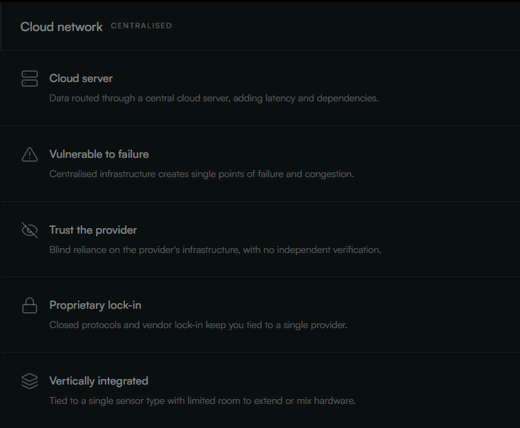
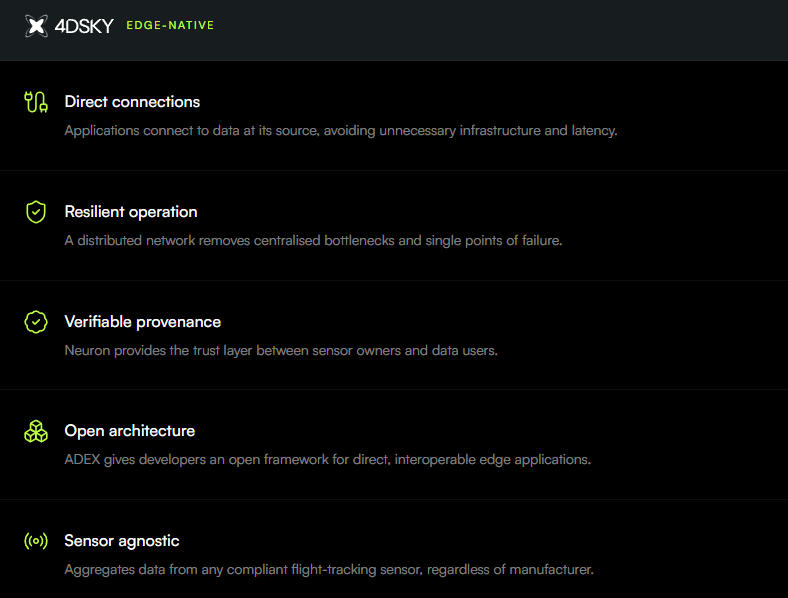
4DSKY’s solution was to eliminate the server entirely. Instead of routing everything through a central data center, the “server” lives inside the sensor itself, and client systems connect directly to the sensors. No central server, no single point of failure, no bottleneck, just real-time, low-latency data.
That design has another benefit that doesn’t get talked about enough. Removing the central server also removes central ownership. A company like Google Wing or Amazon may not want to be 100% reliant on one data vendor. Spreading that risk across thousands of independent sensor owners is a far more attractive proposition for a large enterprise buyer.
The underlying technology that makes this possible is Neuron’s protocol, which handles the direct edge connectivity between sensors and clients. It also solves a problem that big companies care deeply about: privacy. A company like Google probably doesn’t want every one of its flights visible on the public internet. Neuron’s architecture uses public networks on the supply side and private networks on the client side, so customers can consume data without broadcasting their own operations.
If you want to nerd out a little, here is the full online documentation for 4DSKY
Why altitude and timing matter
Knowing where an aircraft is on a map isn’t enough for drone delivery. You need its height, in real time. Whether a drone releases a package at 50 feet or 5 feet is a massive difference.
This is where the hardware gets interesting. Aircraft don’t all use the same type of transponder. The majority, around 50 to 60% according to James, broadcast ADS-B on 1090 MHz. Others use FLARM, common on gliders and light aircraft, and in the U.S. you’ll also find UAT, which is used heavily by general aviation. If you want to see all the traffic, which is exactly what safe drone operations require, you need to cover all the frequencies relevant to your region.
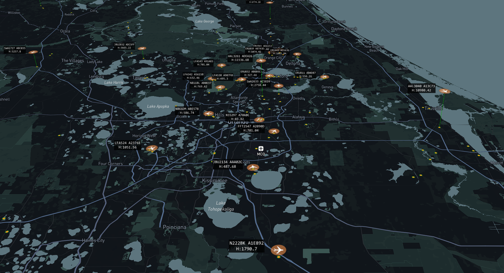
On top of that, not every aircraft broadcasts its GPS position. For those, the network uses precise timing. When multiple sensors in an area record exactly when they received a signal, that timing data can be used to triangulate the aircraft’s position to within about 30 meters. That same technique can also validate GPS positions, which matters in parts of the world where GPS spoofing is a real problem. It’s not just about finding more aircraft; it’s about verifying and securing the data on the aircraft you can already see.
This is also why these sensors aren’t $200 gadgets. Cheap receivers exist, but they lack the timing technology and the extra frequency bands. James noted that comparable professional equipment typically runs upward of $3,000 per sensor, while the Jetvision unit comes in at roughly $1,000. It’s also the same hardware family used by some of the biggest flight tracking networks in the world, including Flightradar24 and FlightAware.
Where and How to buy a 4DSKY Jetvision Airsquitter and Sensor Antennas
Real customers, real revenue
Here’s the part that gets me most excited, and anyone who follows my channel knows why. I’m a huge advocate for DePIN projects that focus on revenue and business development instead of just selling hardware.
4DSKY is already generating recurring revenue before mainnet. According to James, the team is working with the UK Civil Aviation Authority, the UK’s equivalent of the FAA, on national-scale infrastructure. They’re working with Tekever, which James described as Europe’s largest drone company, recently valued at around $5.5 billion after raising half a billion dollars, with operations across multiple European countries in both civilian and defense markets. They’re also involved in projects with the European Space Agency around distributed and acoustic sensing for detecting rogue drones, and with UK government agencies interested in accessing this data.
Beyond that, 4DSKY has previously been tied to an open-source flight information system installed at a UK airport, as well as a military-related tie-up with NATO. The team is currently a group of six, scaling to about 15 people over the next few months off the back of these contracts.
It’s worth being clear: 4DSKY is not partnered with Amazon. But the use cases stretch far beyond package delivery. Drones will increasingly inspect power lines, rail lines, roads, and bridges. Autonomous drone docks will launch drones on their own to survey infrastructure. There’s search and rescue, crop monitoring, precision farming, and ship landings. The team has also mentioned future roadmap expansion into areas like automotive, shipping, agriculture, and environmental data. Every one of those needs a reliable, real-time picture of the sky.
Checkout the my full site down interview with James from 4DSKY.

Where the Project Stands Today
Let me set expectations honestly, because this is important.
As of September 2026, 4DSKY is still in testnet. There’s no token yet. Right now, operators earn points, which serve as a measure of how much data you’ve contributed to the network. Those points have no monetary value today, and the team can’t legally tie them to any payout at this stage. What the team has said is that they intend to reward the people who contributed the most, especially early adopters, when the time comes.
Points are earned based on factors like uptime and location. Early on, the published structure included 25 base points per day, with bonuses of up to 50% for proximity to airports and up to 20% for optimal sky visibility, plus an announced 20% bonus for running the additional antennas. Expect this to evolve.
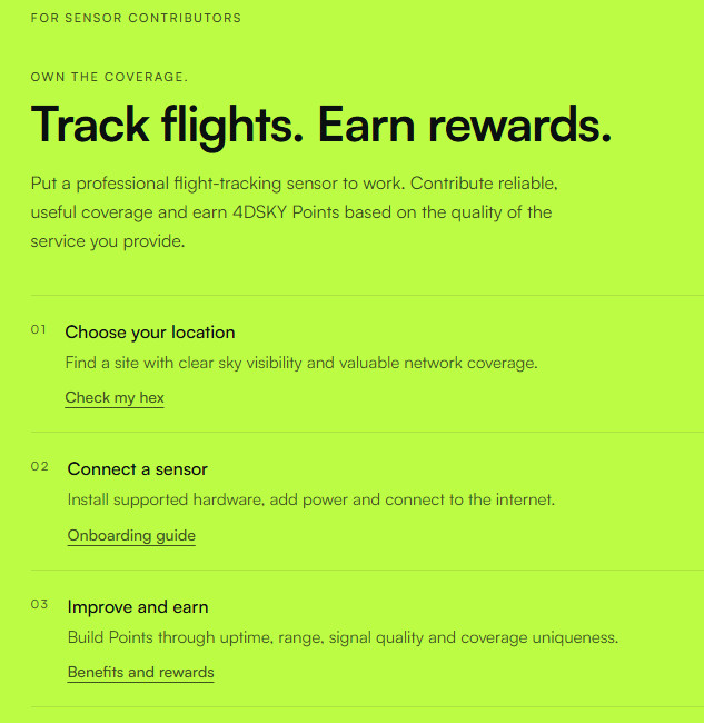
The network currently uses hexes of roughly 2 km, with the first sensor in a hex earning maximum points and additional sensors sharing reduced rewards. But the team told me they’re moving toward an airspace coverage model, where you earn points based on the actual blocks of airspace your sensor can see. They’re also planning bonuses for drone delivery cities, and they’re running proof-of-concept projects with large drone delivery clients in a few U.S. cities. Importantly, they still want multiple sensors covering the same airspace, both for triangulation and for redundancy. If someone unplugs their sensor, planes shouldn’t be flying blind.
I also pushed on something I care about: first isn’t always best. On other projects, I’m not the first device in my hex, but I’m providing the highest-quality data. James confirmed quality-based rewards have been discussed internally, and the long-term focus is on what your sensor can actually see and contribute.
The Road to Mainnet
Earlier documentation targeted a 2026 mainnet launch. When I asked James directly, he wisely wouldn’t commit to a date on my channel. Here’s the plan he laid out instead.
In the short term, the team intends to start issuing small USDC rewards to operators. Think of it as a thank you to the community and a way to test the reward infrastructure. The full reward mechanism is expected to switch on once the network reaches roughly $1 to $2 million in annual recurring revenue. Small business strategy honestly, I love to see it!
The project currently runs on Hedera, chosen not for hype but for a specific technical reason: its topic system lets every device cheaply broadcast its heartbeat, state, and service messages onchain. Because 4DSKY decentralizes both ownership and the infrastructure itself, all of that data needs to live onchain rather than in a central cloud. The team has also said the technology can be integrated with other chains, and they have letters of intent signed with other DePIN projects.
The tokenomics model is one I really like. Customers won’t be forced to buy a token. They’ll load their account with U.S. dollars, which becomes USDC behind the scenes. That USDC pays a smart contract for network data, and the smart contract buys back the token from the market, accruing value to the early operators who built the network. As James put it, a token launched into a revenue generating business is going to do far better than one launched with zero revenue.
Why Home Miners Shouldn’t sleep on 4dsky
So why should home miners care? A few reasons stand out to me.
It’s genuinely early. When I first installed my unit, there were only around 300 active devices worldwide. At the time, the entire state of Texas had just three. There’s no locking out of your area either; the network wants more sensors, not fewer. We all know how getting in early on successful DePIN projects has played out historically.
The use case is real and growing. Drone delivery isn’t coming; it’s already here. The network is being built ahead of the demand, and paying customers are already on board.
The install is flexible. I went the full route on my rural Pennsylvania property: the Air Squitter inside my mining shed, and both the ADS-B and UAT antennas mounted at the peak of the shed about 15 to 20 feet up, with totally open sky around it. The hardware took about an hour, even in the middle of a freezing February. The included cables are 30 feet each, and the bracket works for pole or wall mounting.
Checkout my full installation video for my 4DSKY
But you don’t need a compound like mine. An attic works nearly as well as a rooftop, as long as the roof isn’t metal. James himself runs his unit on a 19th-floor balcony in London with only about 180 degrees of view, but that view points straight down the runway at London City Airport. That’s the key insight: it’s not just how much sky you see, but what’s in that sky. If you can look out your window and see aircraft, you likely have a valuable location. Even a unit in a window of a high-rise adds to the network. Ethernet is recommended, though Wi-Fi works.
The install barrier is a feature. It’s more involved than plug-and-play miners. That keeps the network from being flooded overnight, which is good for early operators.
The Honest Caveats
Now for the transparency. This is a speculative play. The hardware isn’t cheap, sitting on the pricier end of the DePIN world. There’s no daily profitability yet, no token yet, and no guarantee the project ever reaches mainnet or succeeds. If you need ROI you can calculate today, this isn’t for you yet. Give it time and wait for mainnet. But if you have disposable income and like getting in on well-built projects before the crowd, this is exactly the kind of opportunity I look for. Where my mind goes is, could this be the next super early Geodet or Helium 5G?
Where and How to buy a 4DSKY Jetvision Airsquitter and Sensor Antennas
4DSKY checks the boxes I care most about in a DePIN project: an experienced team with real industry credibility, a clear technical advantage in removing central points of failure, a real-world problem that’s only getting bigger, and actual paying customers before a token even exists. As someone who’s been running one on my property for about a year, I’m excited, not just for 4DSKY, but for what drone delivery and autonomous aviation will look like in the years ahead.
If you want to get started, check out the 4DSKY map explorer to see what coverage looks like near you, and if you decide to pick up a unit from Helium Deploy, make sure you choose the correct antenna for your region.
As always, this is not financial advice. Do your own research!
Finally come share your thoughts on 4DSKY in The Hobbyist Miner Community Discord, free to join here!